Mut Peak
Summit hike above Tirolo
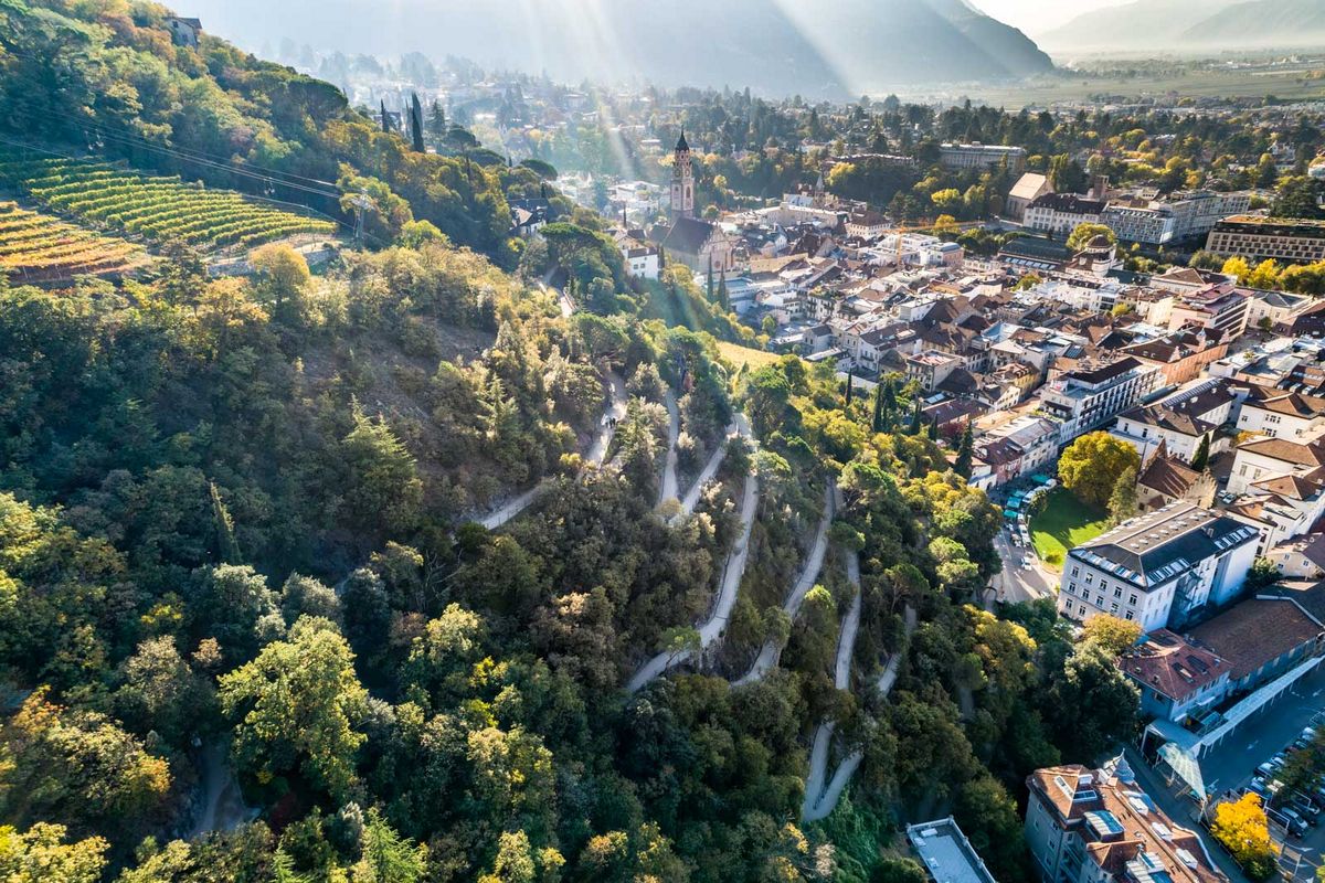
The striking peak of the Mut summit, also known as the "gateway" to the Texel Group, rises up clearly visible north of Merano above Tirolo village at an altitude of 2294 meters.
The Mutspitze can be reached from Tirolo, from the Spronser Lakes and via the Taufenscharte via well-maintained hiking trails. In good weather, the view reaches from the Ötztal Alps to the Dolomites and the Ortler area.
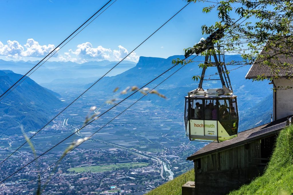
We choose the "classic" variant, which starts at the valley station of the Hochmut cable car in Tirolo. In the early morning there is still enough (free) parking space available, after buying the ticket we start right away.
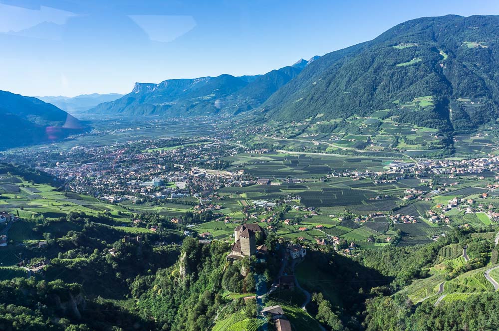
From the valley station of the cable car, you can enjoy a gigantic view of Castle Tyrol and the Merano valley basin after just a few moments.
Arriving at the top station, on the Muthöfe, we forgo the coffee on the tempting terrace and immediately begin the ascent. It is high summer and we want to be at the summit before the big rush.Via stairs it goes up to the fork in the road: left is the Merano high trail to the Leiter Hut, we keep right and begin the ascent to the Mutkopf.
We choose the "classic" variant, which starts at the valley station of the Hochmut cable car in Tirolo. In the early morning there is still enough (free) parking space available, after buying the ticket we start right away.
From the valley station of the cable car, you can enjoy a gigantic view of Castle Tyrol and the Merano valley basin after just a few moments.
Arriving at the top station, on the Muthöfe, we forgo the coffee on the tempting terrace and immediately begin the ascent. It is high summer and we want to be at the summit before the big rush.Via stairs it goes up to the fork in the road: left is the Merano high trail to the Leiter Hut, we keep right and begin the ascent to the Mutkopf.
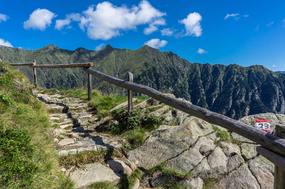
Just above the Muthöfe the trail is challenging on a well-maintained path in the direction of the Mutkopf, but then it really gets down to business: there are still 500 meters of altitude to climb to the summit, which are not for free. On a very well developed hiking trail it goes in a zig-zag course up to the tree line.
Up to the fork with the Jägersteig, which leads north to the Bocker Hut and into the Spronser Valley, the 200 meters is more and more exposed, with every change of direction of the hiking trail the views over Meran to the left, on the Spronser Valley and the Hahnenkamm to the right change.
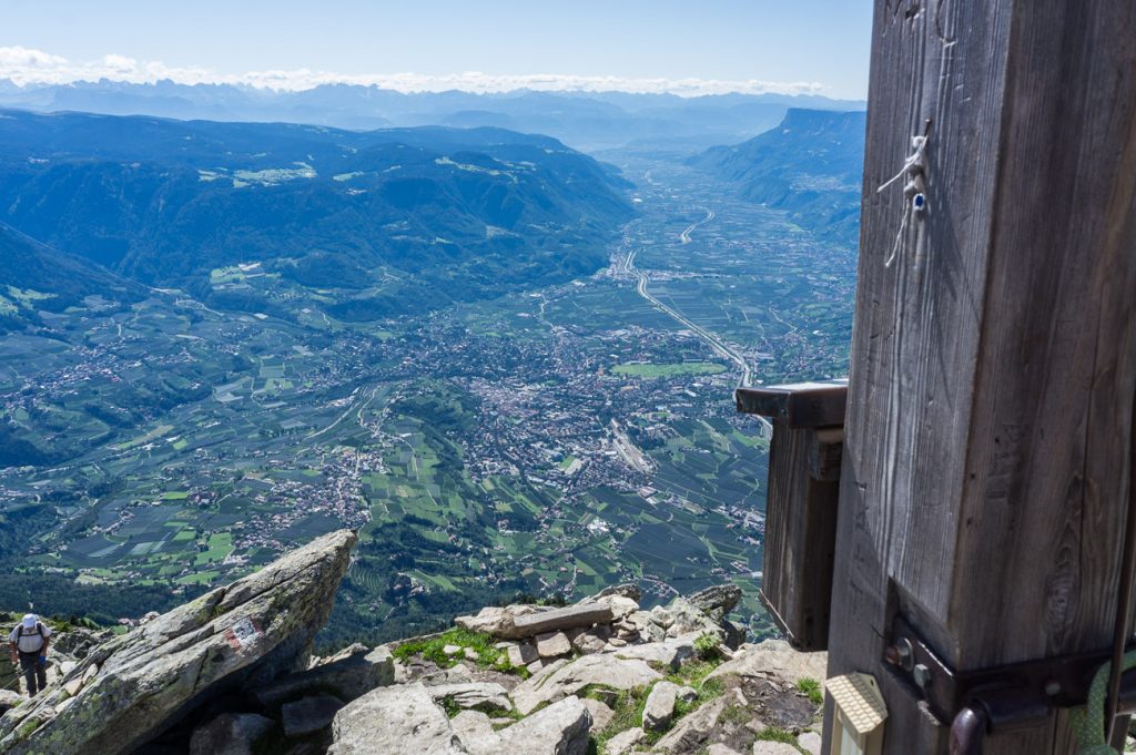
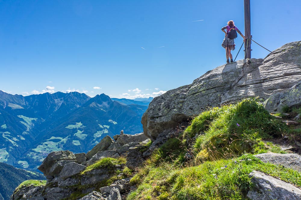
The summit of the Mut presents itself as an ensemble of large stone blocks with a massive summit cross at its highest point. Up to here you can hear the rush of the Adige river, which flows from the Tell towards Merano. The view wanders from the alpine pastures far below and the neighboring Rötelspitze to the Spronser lakes, as well as over the Etsch valley to the Oltradige Region.
Up to the fork with the Jägersteig, which leads north to the Bocker Hut and into the Spronser Valley, the 200 meters is more and more exposed, with every change of direction of the hiking trail the views over Meran to the left, on the Spronser Valley and the Hahnenkamm to the right change.
The summit of the Mut presents itself as an ensemble of large stone blocks with a massive summit cross at its highest point. Up to here you can hear the rush of the Adige river, which flows from the Tell towards Merano. The view wanders from the alpine pastures far below and the neighboring Rötelspitze to the Spronser lakes, as well as over the Etsch valley to the Oltradige Region.
Descent from the Mut Peak
The descent from the Mut Peak can be mastered via the normal route, i.e. the same as the ascent route.
Alternatively, the Taufenscharte is ideal for turning this summit hike into a circular hike: From the summit, this variant leads north to the Taufenscharte, where the descent to the Leiter Hut begins.
We choose the route via the Spronser lakes and after about 5 more hours and descent via the Hochgangscharte we return to the Leiter Hut, where we enjoy an excellent Kaiserschmarren and friendly service!
From the Leiter Alm we then return along the Merano high hiking trail to the Muthöfe with the top station of the cable car.
Directions
With the cable car Hochmut from Tirol village
Ascent
From the Muthöfe approx. 2,5 ascent (900 m altitude difference)
Doable in all seasons, if there is no snow. In cold temperatures, watch out for ice on the path - danger of slipping!
With the cable car Hochmut from Tirol village
Ascent
From the Muthöfe approx. 2,5 ascent (900 m altitude difference)
Doable in all seasons, if there is no snow. In cold temperatures, watch out for ice on the path - danger of slipping!