
Orenknott
A moderately difficult, little known hike, about which relatively little is reported. A pity actually, this route on the Meraner high trail, but off the beaten track, is one of the most beautiful hikes in Merano! Who has made this hike high above Parcines but will certainly like to remember the view from the summit cross on the surrounding mountain landscape and the valley far below!
Ascent
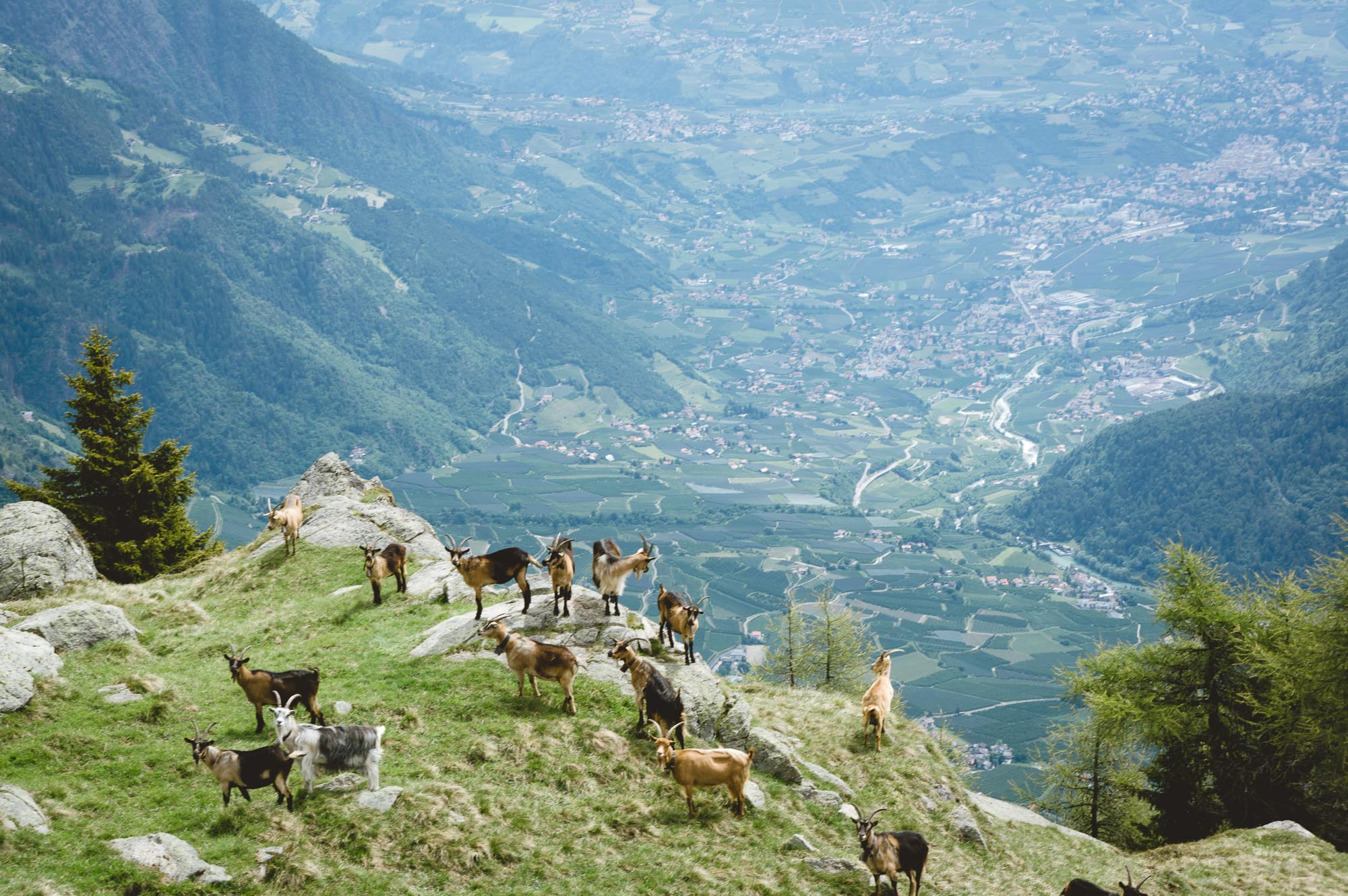
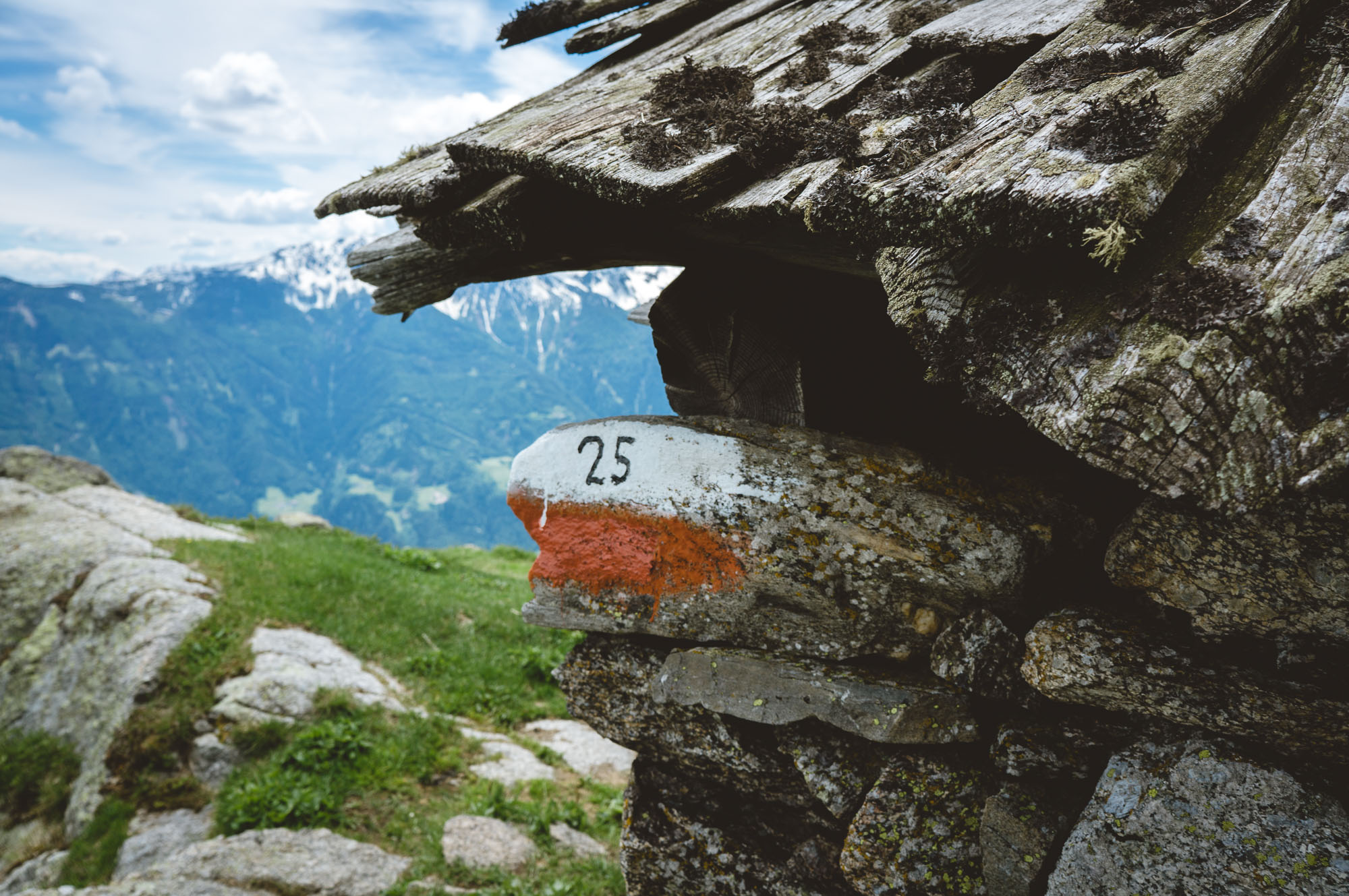
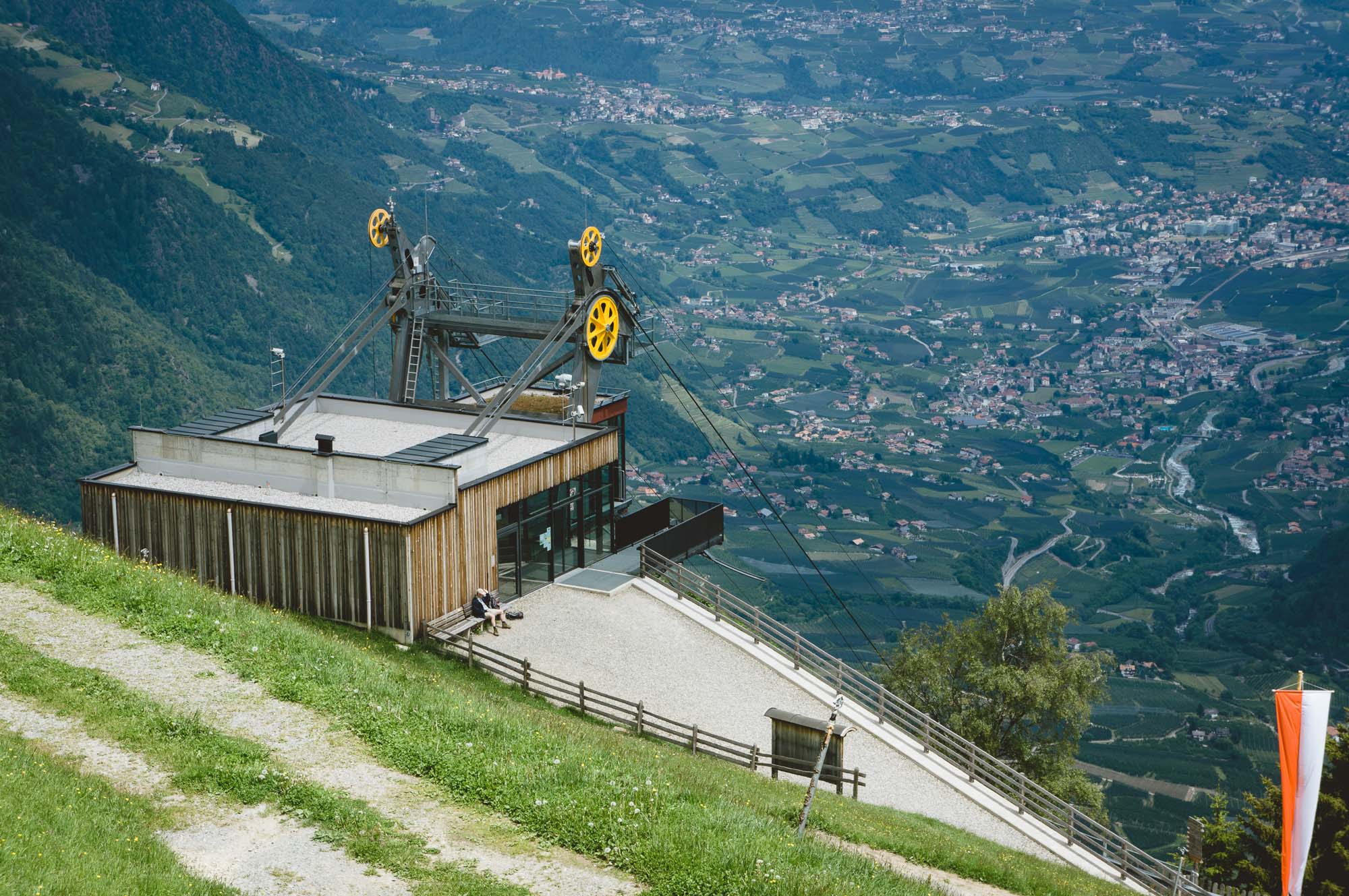
From the top station of the cable car you pass the Giggelberg Restaurant, immediately after which you turn right onto hiking trail no. 2, which leads quite jaggedly upwards. Passing a picturesque little lake, the wall trail leads into the forest up to the timberline. Halfway there, leave trail no. 25 , which leads to the target peak, and follow the signs, which lead to the Ohrenknott. After about 20 minutes of level hiking, the path goes up again properly, the last 400 meters of altitude lead up over the forest border to the day's destination, the Orenknott.
The summit
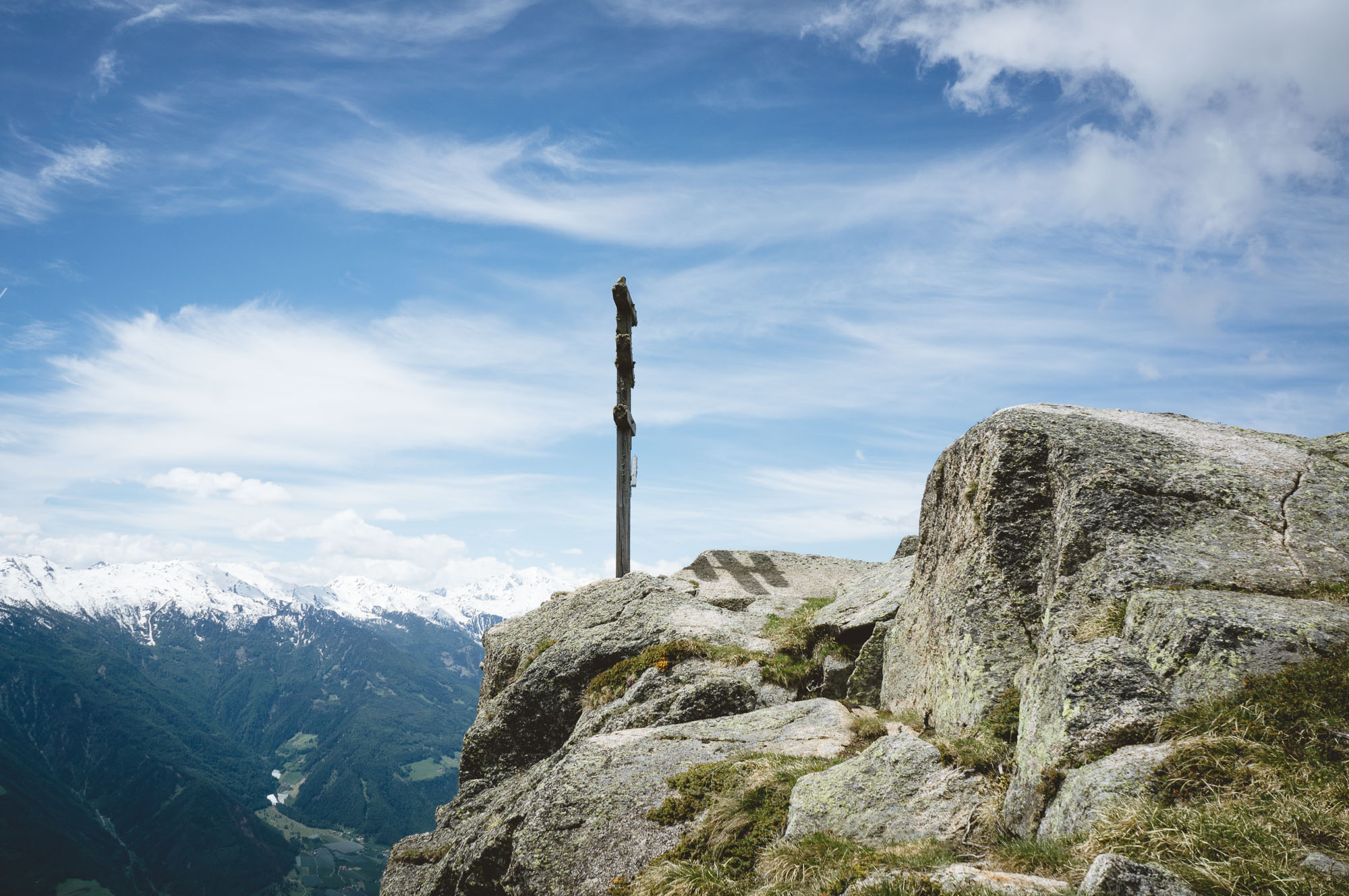
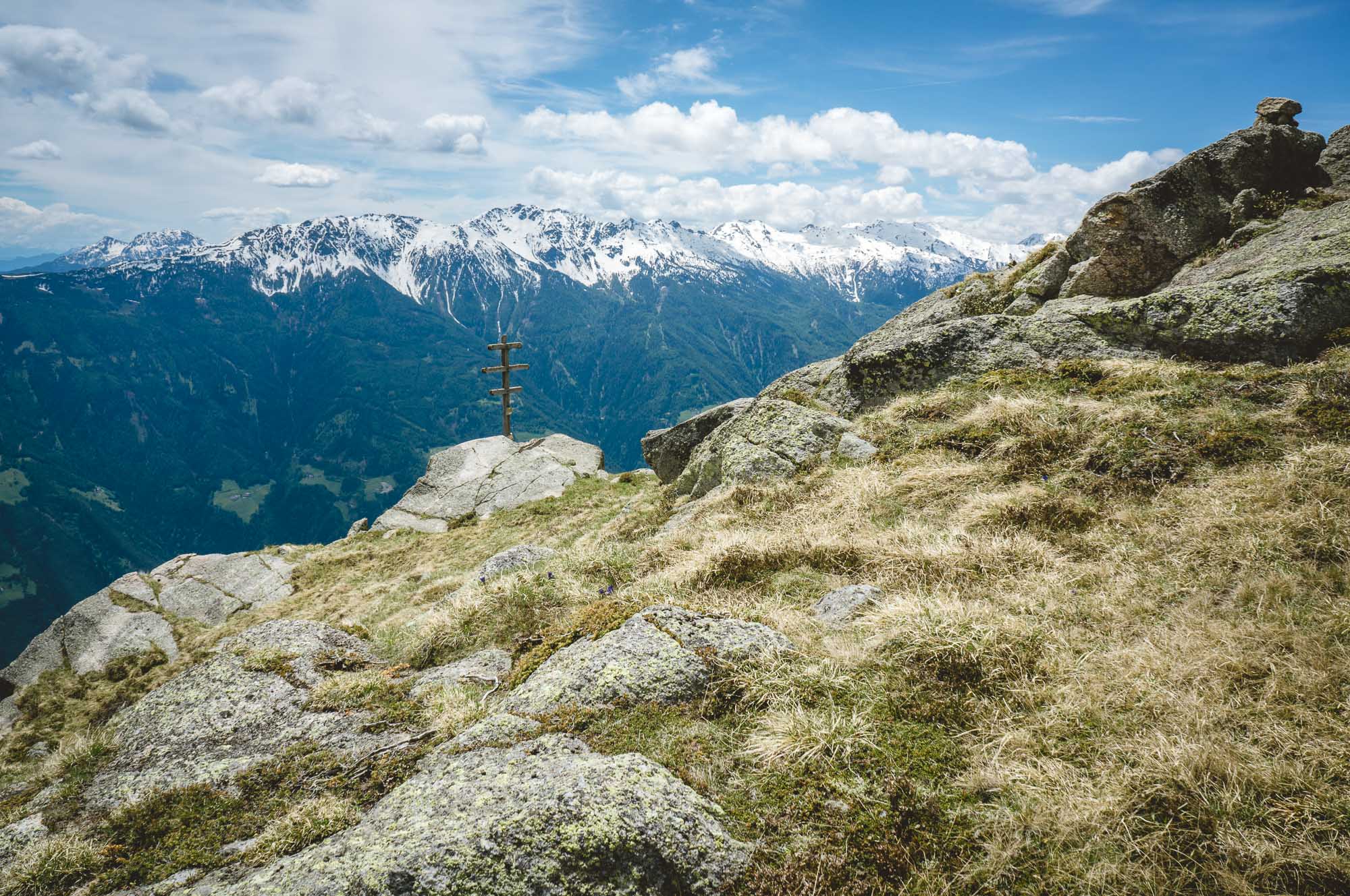
From the west, you reach the summit plateau, which is littered with large boulders and stands on a rocky summit structure about 50 meters high, via a small saddle. The summit cross rests in a picturesque position on the vertical precipice towards the valley.
The view is gigantic and stretches from the target peak above over the remaining peaks of the Gruppo di Tessa to the Merano valley basin. Opposite is the Monte Tramontana with San Vigilio and the Naturnser Hochwart. To the east you can see the Ortler and Cevedale groups. Directly below you can see the villages of Parcines, Rablà and Naturno. There is enough space to rest on wind-protected spots between the rocks, which are covered with soft grass.
From the top station of the cable car you pass the Giggelberg Restaurant, immediately after which you turn right onto hiking trail no. 2, which leads quite jaggedly upwards. Passing a picturesque little lake, the wall trail leads into the forest up to the timberline. Halfway there, leave trail no. 25 , which leads to the target peak, and follow the signs, which lead to the Ohrenknott. After about 20 minutes of level hiking, the path goes up again properly, the last 400 meters of altitude lead up over the forest border to the day's destination, the Orenknott.
The summit
From the west, you reach the summit plateau, which is littered with large boulders and stands on a rocky summit structure about 50 meters high, via a small saddle. The summit cross rests in a picturesque position on the vertical precipice towards the valley.
The view is gigantic and stretches from the target peak above over the remaining peaks of the Gruppo di Tessa to the Merano valley basin. Opposite is the Monte Tramontana with San Vigilio and the Naturnser Hochwart. To the east you can see the Ortler and Cevedale groups. Directly below you can see the villages of Parcines, Rablà and Naturno. There is enough space to rest on wind-protected spots between the rocks, which are covered with soft grass.
The descent
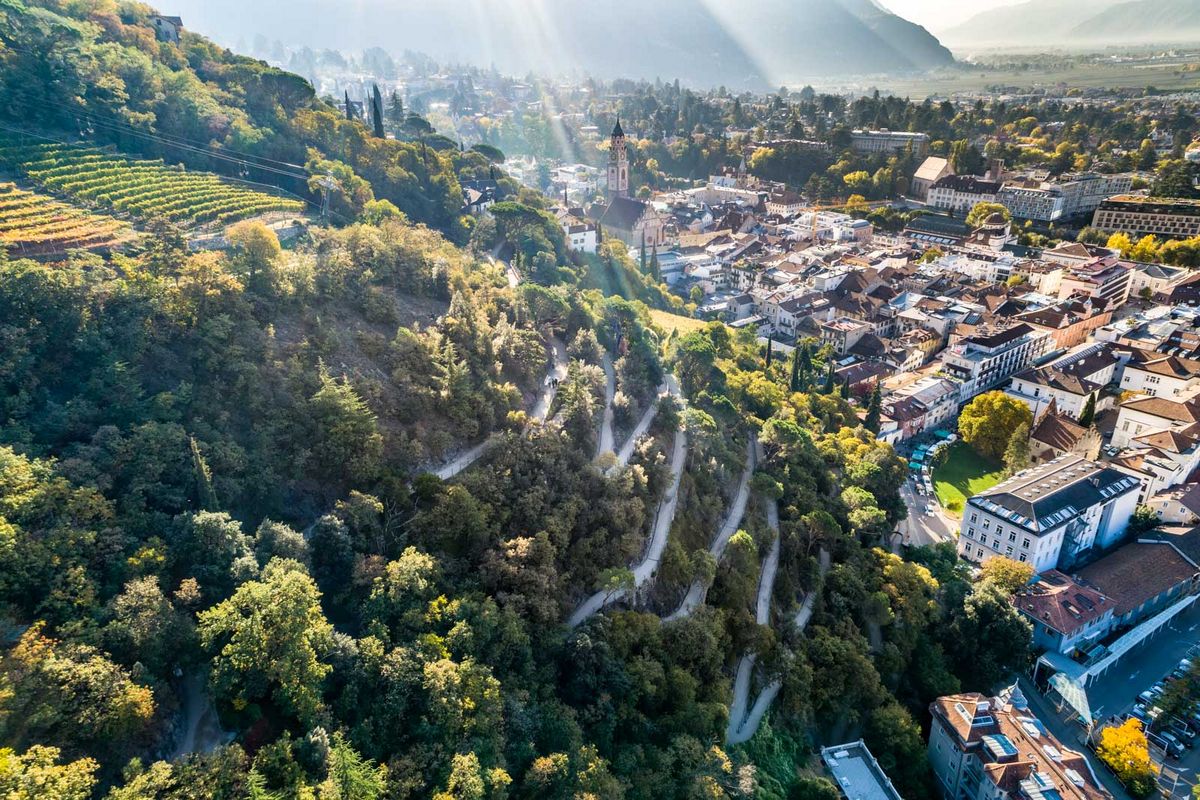
The best way to descend is via path no. 24, after having used the same path as for the ascent for a short part of the way. This leads through the forest past the unmanaged Orenalm and joins the Meraner high trail at the Hochforch inn.
This leads back to the mountain station, where after an initial reduction in altitude, another 100 meters of altitude have to be made up again via a stepped path.
Directions: Coming from Merano it takes about 20 minutes by car to reach Rablà. Follow the signs for the Texel Cable Car. There is ample free parking directly at the valley station. The tour starts at the top station of the Texel cable car.
Costs/Hours: The ride up and down the mountain costs €12 for adults - the lift operates from 08 - 18 hours, in high season from 07 - 19 hours.
Refreshments: Gasthof Giggelberg at the mountain station, Gasthaus Hochforch on the Merano high trail.
Costs/Hours: The ride up and down the mountain costs €12 for adults - the lift operates from 08 - 18 hours, in high season from 07 - 19 hours.
Refreshments: Gasthof Giggelberg at the mountain station, Gasthaus Hochforch on the Merano high trail.


Recommended accommodations

Prinz Rudolf Smarthotel

Hotel Der Waldhof

Hotel Sonnenburg

Hotel Pazeider
Prinz Rudolf Smarthotel
Hotel Der Waldhof
Hotel Sonnenburg
Hotel Pazeider